This list of sites along the entire Byway are listed in order from west to east along the Minnesota River Valley.
For your convenience, we have separated the Byway into segments. Click on any of the icons below to view the list of sites in that particular segment of the Byway.
![]()
![]()
![]()
![]()
![]()
![]()
![]()
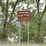
Continental Divide
View on Map Open in Google MapsThe city of Browns Valley is located along the Laurentian Continental Divide, a small rise in the land which influences whether water flows north to the Hudson or south to the Gulf of Mexico.
W Broadway Ave.Browns Valley, MN 56219
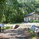
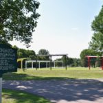
Samuel J. Brown Memorial Park
View on Map Open in Google MapsA historic cabin where you can learn about Browns Valley’s history.
W Broadway Ave.Browns Valley, MN 56219
320-695-2608
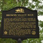
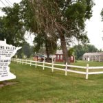
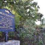
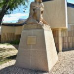
Browns Valley Man
View on Map Open in Google MapsUncovered in 1933, experts named the bone fragments “Browns Valley Man” and estimated it to be 9,000 years old.
TH 28/7 EBrowns Valley, MN 56219
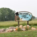
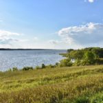
Big Stone Lake State Park
View on Map Open in Google MapsNestled on the shores of Big Stone Lake, or Bde Iŋyaŋ Takiŋyaŋyaŋ, this state park offers visitors a quiet camping experience complete with fishing, swimming, hiking and bird watching.
35889 E MeadowbrookOrtonville, MN 56278
320-839-3663
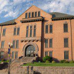
Ortonville Historic Buildings
View on Map Open in Google MapsA group of more than 15 historic properties along the shore of Big Stone Lake.
Hwy. 12 & Hwy. 75Ortonville, MN 56278
320-839-3359
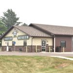
Big Stone County Museum
View on Map Open in Google MapsBuilt on the site of Paul Bunyan’s anchor, this museum features many treasures of the past and interpretations about life as a pioneer.
985 U.S. 12Ortonville, MN 56278
(320) 839-3359
Big Stone National Wildlife Refuge
View on Map Open in Google MapsDrive or bike the auto tour where you can enjoy the granite outcrops, wetlands and woodlands, prairie.
44843 687th Avenue, County Highway 19Odessa, MN 56276
320-273-2191
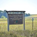
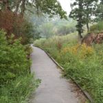
Plover Prairie
View on Map Open in Google MapsA beautiful nature preserve with a wide variety of plant and animal species.
Odessa, MN 56276
Marsh Lake Dam
View on Map Open in Google MapsA lake on the Minnesota River with abundant fish, waterfowl and wildlife.
Appleton, Minnesota 56208
Chippewa Prairie
View on Map Open in Google MapsNatural A small prairie remnant of the once vast northern tallgrass prairie ecosystem.
Appleton, Minnesota
Arv Hus Museum
View on Map Open in Google MapsSawdust art, handcrafts, vintage photos and pioneer items from the culturally rich Milan area, with historian and curator Billy Thompson who has stories to tell that will keep you laughing all day!
228 Main St.Milan, MN 56262
320-734-4829
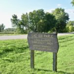
Lac qui Parle Wildlife Management Area
View on Map Open in Google MapsWith more than 33,000 acres of land and water, this WMA is made up of wetlands, brushlands, woodlands, and native prairie and provides great habitat for birds and wildlife.
14047 20th St. NWWatson, MN
Lac qui Parle State Park
View on Map Open in Google MapsThis state park on Lac qui Parle Lake (in Dakota, Bde Iedaŋ ,or “little talking lake.”) has abundant wildlife and waterfowl, and includes the historic Fort Renville and Lac qui Parle Mission.
Watson, MN 56295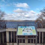
Fort Renville Historic Site
View on Map Open in Google MapsFort Renville was a fur trading post established in 1826 at a Waḣpetuŋwaŋ Dakota village on the shore of the Minnesota River.
173 140th Avenue NWWatson, MN 56295
320-269-7636
Lac qui Parle Mission
View on Map Open in Google MapsJoseph Renville invited missionaries to establish the Lac qui Parle Mission near this post in 1835.
115 140th Ave NWWatson, MN 56295
Lac qui Parle County History Center
View on Map Open in Google MapsExhibits feature the pioneer lifestyle, agriculture, Civil War artifacts and more. Robert Bly Study.
250 8th Ave SMadison, MN 56256
320-598-7678
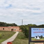
Camp Release State Monument
View on Map Open in Google MapsAn important location in the US - Dakota War of 1862, this site is where the Dakota re-released 269 white captives and about 1,200 Dakota people surrendered to the victorious U.S. armies at the end of the war.
Montevideo, MN 56265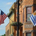
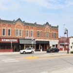
Montevideo Historic Buildings
View on Map Open in Google MapsJoin us in Montevideo as we celebrate what makes America so great, keeping the history of our individuals while coming together as one people. Sites of interest in the area include: Chippewa Historic Village Camp Release Monument Minnesota River Rapids Milwaukee Road Heritage Center Hollywood Theater on Main Historic Swenson Farm in Montevideo
Montevideo, MN 562651-800-269-5527
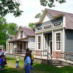
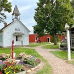
Historic Chippewa City
View on Map Open in Google MapsA unique, 24-building, turn-of-the century village has been recreated here.
151 Pioneer DriveMontevideo, MN 56265
320-269-7636
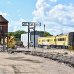
Milwaukee Road Heritage Depot
View on Map Open in Google MapsThis is a museum reviving the history of the Milwaukee Road Railroad.
301 State RoadMontevideo, MN 56265
Olof Swensson Farm Museum
View on Map Open in Google MapsA 22-room house, timber-framed barn, family burial cemetery and remains of a grist mill.
256 100th St SEGranite Falls, MN 56241
320-269-7636

Granite Falls Downtown District and River
View on Map Open in Google MapsShop, fish, picnic, or kayak in downtown Granite Falls along the Minnesota River.
Granite Falls, MN 56241320-564-3743
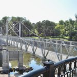
Granite Falls Footbridge
View on Map Open in Google MapsA footbridge in downtown Granite Falls that crosses the Minnesota River and was designed by the famous Roebling & Sons Company.
813 Prentice StGranite Falls, MN 56241
320.564.4039
Andrew J. Volstead House Museum
View on Map Open in Google MapsThis National Historic Landmark is a restored home that tells the story of Andrew Volstead and his family.
163 9th Ave.Granite Falls, MN 56241
320-564-3011
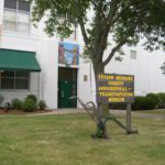
Yellow Medicine County Historical Museum
View on Map Open in Google MapsA museum that focuses on geology, archaeology and Native American artifacts
98 Minnesota 67Granite Falls, MN 56241
320-564-4479

Fagen Fighters World War II Museum
View on Map Open in Google MapsThis museum is home to the pristine collection of WWII trainer, fighter and bomber aircraft restored, owned and flown by Fagen Fighters.
2450 540th St.Granite Falls, MN 56241
Minnesota's Machinery Museum
View on Map Open in Google MapsRecapturing a century of stories about farm life, this museum features a six-acre plot filled with farm implements, tools, tractors, rural art and more.
1st Ave. WHanley Falls, MN 56245
507-768-3522

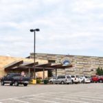
Upper Sioux Community and Prairie's Edge Casino and Hotel
View on Map Open in Google MapsThe Upper Sioux Community (or Pejuhutazizi Kapi) is a federally recognized Indian tribe and is host of the Prairie’s Edge Casino Resort.
5722 Travers LnGranite Falls, MN 56241
320.564.2121
Sacred Heart Area Museum
View on Map Open in Google MapsA museum with photographs and other memorabilia from the early pioneer days of Sacred Heart and the surrounding area.
300 5th Ave.Sacred Heart, MN 56285
Renville County Parks: Skalbekken
View on Map Open in Google MapsExperience the scenic water views with rushing waters of Limbo Creek, Hawk Creek and the Minnesota River at Skalkbekken County Park.
79257 County Road 10Sacred Heart, MN 56285
320-523-3747
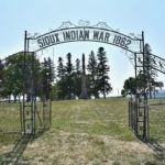
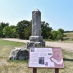
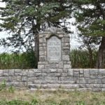
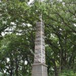
Wood Lake Monument and Battlefield
View on Map Open in Google MapsA tall granite monument erected by the State of Minnesota in 1919 near the Wood Lake Battlefield.
2136 600th StreetEcho, MN 56237
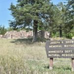
Joseph R. Brown State Wayside Rest
View on Map Open in Google MapsThis wayside rest displays granite ruins of Joseph R. Brown’s home which was destroyed during the U.S.-Dakota War of 1862.
76734 145th StreetSacred Heart, MN
320-564-4777
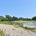
Renville County Parks: Vicksburg
View on Map Open in Google MapsPart of the Renville County Park system featuring history, camping, picnicking, canoeing, and a sandbar.
73715 County Road 6Renville, MN 56284
320-523-3747
Schwandt Memorial
View on Map Open in Google MapsThis was erected in 1915 in memory of Johan and Christian Schwandt who were killed in the U.S.-Dakota War of 1862.
Olivia, MN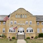
Redwood County Historical Society (Poor Farm Museum)
View on Map Open in Google MapsThe Old Redwood County Poor Farm houses is a museum with a variety of exhibits.
913 W Bridge St.Redwood Falls, MN 56283
507-637-3329
Redwood Falls Historic Buildings
View on Map Open in Google MapsSome of the Redwood Falls historic buildings are: the courthouse, saw mill, and many downtown buildings.
200 South Mill StreetRedwood, MN 56283
507-637-2828
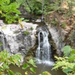
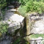
Ramsey Park, Caŋ ŝa yapi
View on Map Open in Google MapsA city park with the picturesque Ramsey Falls and the Swayback Bridge. The park is also known by its Dakota name Caŋ ŝa yapi where they paint the trees red.
333 S WashingtonRedwood Falls, MN 56283
507-637-5755
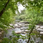
Renville County Parks: Beaver Falls
View on Map Open in Google MapsPart of the Renville County Park system that features impressive overlooks, the wooded and cascading waters of Beaver Creek, and a horse camp.
31521 County Road 2Morton, MN 56270
320-523-3747
Birch Coulee Battlefield State Historic Site
View on Map Open in Google MapsThe Dakota’s most successful engagement during the U.S.-Dakota War of 1862 was fought at Birch Coulee.
Jct of Renville Cty Hwy 2 and Hwy 18Morton, MN 56270
651-259-3473
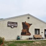
Renville County Historical Museum
View on Map Open in Google MapsA museum packed with many exhibits, research library and a 1869 log cabin.
441 N Park DrMorton, MN 56270
507-697-6147
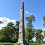
Morton Monuments
View on Map Open in Google MapsTwo obelisk markers are located up on the bluff near Morton to honor combatants of the U.S.- Dakota War of 1862.
35003 650th AveMorton, MN 56270
Lower Sioux Agency Historic Site
View on Map Open in Google MapsFind a dynamic Interpretive center and extensive trail system where you can explore the history and culture of the Dakota Oyate.
32469 Redwood County Hwy. 2Morton, MN 56270
507-697-6321
Lower Sioux Community and Jackpot Junction Casino Hotel
View on Map Open in Google MapsThe Lower Sioux Indian Community is a federally recognized Indian tribe and is host of the Jackpot Junction Casino Hotel.
39527 Res Hwy 1Morton, MN 56270
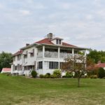
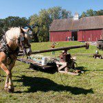
Gilfillan Farm Estate
View on Map Open in Google MapsAn estate with a farm house to tour, as well as beautiful grounds. The site of Farmfest.
28315 Co. Hwy 13Morgan, MN 56266
507-249-2210
Fort Ridgely State Park & Historic Site
View on Map Open in Google MapsThis state park offers opportunities for camping, hiking, picnicking, horse trails and access to the historic Fort Ridgely.
72158 County Road 30Fairfax, MN 55332
507-426-7840
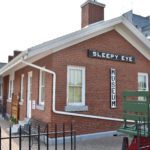
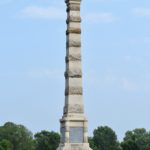
Sleepy Eye Depot Museum
View on Map Open in Google MapsA restored train depot houses a museum. Dakota Chief Sleepy Eye is buried on site under an impressive obelisk, with a full-size statue of him across the street.
100 Oak St. NWSleepy Eye, MN 56085
507-794-5053
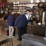
Harkin Store
View on Map Open in Google MapsA 1870s general store where you can savor the sights and smells as you sample the wares or sit down for a game of checkers.
66250 County Road 21New Ulm, MN 56073
507- 354-8666
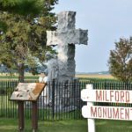
Milford Monument
View on Map Open in Google MapsOnce a small settlement, a monument stands where more than 50 Milford Township residents were killed during the U.S.-Dakota War of 1862, making it one of the hardest-hit communities during the war.
County Road 11Brown, Minnesota 56073
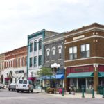
New Ulm Historic District
View on Map Open in Google MapsNew Ulm is a German city on the Minnesota River.
New Ulm, MN 56073507-233-4300
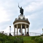
Hermann Monument
View on Map Open in Google MapsA 102’ tall monument and statue in New Ulm, MN to honor an ancient German hero.
Center & Monument StreetsNew Ulm, MN 56073
507-233-4300

Wanda Gág House Interpretive Center and Museum
View on Map Open in Google MapsThe childhood home turned museum of Wanda Hazel Gag, author of classic children’s books.
226 N. Washington StreetNew Ulm, MN 56073
507-359-2632
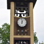
Glockenspiel
View on Map Open in Google MapsThis is a unique 45-foot, free-standing clock tower with animated figures that depict the city’s history in New Ulm, MN
4th N and Minnesota StreetNew Ulm, MN 56087
507-233-4300 or 888-463-9856
Riverside Park Environmental Learning Center
View on Map Open in Google MapsThis learning center displays on the value of the river with a pirate ship playground
Riverside Park, 101 S. Front St.New Ulm, MN 56073
507-354-8367
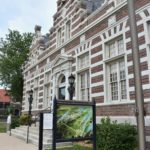
Brown County Historical Museum
View on Map Open in Google MapsThis notable building was built in 1910 in an eye-catching Northern German Renaissance-style, as the town’s Post Office; becoming the County Museum in 1984. Inside are three floors of rotating exhibits, featuring an award-winning exhibit of the U.S.-Dakota War of 1862. It contains over 5,000 family history files to help researchers. Open Mon.-Sat., 10 to 4 pm, May 1 to Oct. 31, reduced hours in the off-season. $5 admittance.
2 N Broadway StNew Ulm, MN 56073
507-233-2616
John Lind House
View on Map Open in Google MapsBuilt by Minnesota’s 14th governor in 1899, the John Lind house has been restored in the style in which it was originally built and is open for tours.
622 Center St.New Ulm, MN 56073
507-354-8802

Minnesota Music Hall of Fame
View on Map Open in Google MapsMinnesota’s museum that honors musicians who have significantly contributed to the Minnesota Music scene.
27 N. BroadwayNew Ulm, MN 56073
507-354-7305

August Schell Brewery Museum
View on Map Open in Google MapsVisit Minnesota’s oldest brewery, the August Schell Brewing Company.
18th St. S & Schell St.New Ulm, MN 56073
507-354-5528
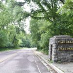
Flandrau State Park
View on Map Open in Google MapsThe gentle flowing Big Cottonwood River meanders through this state park park. The park features a sand-bottom swimming pond, picnic area, campgrounds and group center.
1300 Summit AveNew Ulm, MN 56073
507-233-9800
Minneopa State Park
View on Map Open in Google MapsA major waterfall in southwestern Minnesota tumbles through Minneopa State Park. An old stone mill and traces of Glacial River Warren can be found in the midst of the park’s native prairie that is filled with wildlife. The park offers camping, picnicking, and hiking in summer and cross-country skiing in winter.
54497 Gadwall RdMankato, MN 56001
507-389-5464
Minnemishinona Falls
View on Map Open in Google MapsThis county park is a scenic overlook, 42’ waterfalls located on the Judson Bottom Road.
40923 Judson Bottom RoadMankato, MN 56003

Mankato Historic Districts
View on Map Open in Google MapsMankato is home to two historic districts and 204 total properties on the National Register of Historic Places.
3 civic center PlazaSuite 100
Mankato, MN 56001
507-345-5566
Dakota Wokiksuye Makoce (Land of Memories) Park
View on Map Open in Google MapsThis park offers camping, hiking, river access, fishing, and an annual Wacipi (Pow Wow).
100 Amos Owen LnMankato, MN 56001
507-387-8600

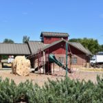
Sibley Park
View on Map Open in Google MapsThis park along the Minnesota River is rich in history, and offers a storybook farm zoo and playground, and many natural areas.
900 Mound AvenueMankato, MN 56265
507-397-8600
Children's Museum of Southern Minnesota
View on Map Open in Google MapsThis is Southern Minnesota’s most immersive and hands-on museum for kids.
224 Lamm StreetMankato,, MN 56001
507-386-0279.
Betsy-Tacy Houses Literary Landmarks
View on Map Open in Google MapsBetsy's House is restored as a museum to look just as it did when author, Maud (Betsy), lived there from 1892-1906. Tacy's House is an interpretive center and gift shop.
332 Center Street333 Center Street
Mankato, MN 56001
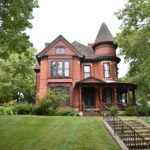
R.D. Hubbard House Museum
View on Map Open in Google MapsBuilt in 1871, this historic house museum stands as one of the finest examples of French Second Empire Style architecture in Minnesota.
606 South Broad StreetMankato, MN 56001
507-345-5566
Blue Earth County History Center and Museum
View on Map Open in Google MapsExplore exhibits featuring people, places, and events that shaped Blue Earth County, Minnesota.
424 Warren StreetMankato, MN 56001
507-345-5566
CityArt Walking Sculpture Tour
View on Map Open in Google MapsExplore these outdoor sculptures displayed year-round in the City Centers of Mankato and North Mankato, Minnesota.
3 civic center PlazaSuite 100
Mankato, MN 56001
800-657-4733

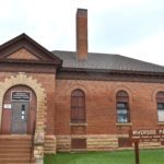
Carnegie Art Center, Mankato
View on Map Open in Google MapsThis renaissance revival-style architecture Carnegie Library now houses a gallery of local artists' work.
120 S. Broad St.Mankato, MN 56001
(507) 625-2730

Reconciliation Park
View on Map Open in Google MapsOn the site of the largest mass execution in U.S. history, the park was dedicated on September 19, 1997, as a collaboration of the Bdewakaŋtuŋwaŋ Dakota and Mankato communities in a spirit of reconciliation.
100 N Riverfront DrMankato, MN 56220
507-387-8600
Winter Warrior and Memorial Marker
View on Map Open in Google MapsA bronze historic marker and limestone sculpture of a Dakota Warrior stands here in honor of the warriors.
209 N Riverfront DrMankato, MN 56001
Riverfront Park
View on Map Open in Google MapsThis park along the Minnesota River offers beautiful views.
310 Rock StreetMankato, MN 56002
507-387-8600
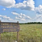
Kasota Prairie Scientific & Natural Area
View on Map Open in Google MapsLocated on a rock terrace 70 feet above the Minnesota River Valley, the Kasota Prairie, meaning “cleared-off plac”, is named for its view. Tread lightly, as there are no walking paths here, but the walking is rated relatively easy and bird watching is good.
Township Road 140Kasota, MN 56050
(651) 296-5484
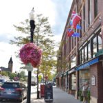
St. Peter Historic District
View on Map Open in Google MapsExplore this historic district, which remains a dynamic walkable downtown full of unique shops, art center, and great eateries.
101 S. Front St.St. Peter, MN 56082
1-800-473-3404
St. Peter State Hospital Museum
View on Map Open in Google MapsThe museum displays the history of Minnesota’s first and oldest state hospital.
100 Freeman DriveSt. Peter, MN 56082
507-985-2249
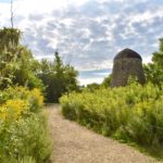
Arboretum at Gustavus Adolphus College
View on Map Open in Google MapsVisitors can enjoy 130 acres of prairie, woodlands, wetlands, gardens, Interpretive Center, and a variety of unique features.
800 W College Ave.St. Peter, MN 56082
507-933-8000
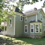
E. St. Julien Cox House
View on Map Open in Google MapsHome to one of the earliest settlers of St. Peter, Eugene Cox, the house was built in 1871, and is one of the few fully restored Italianate homes in Minnesota.
500 N Washington Ave.St. Peter, MN 56082
507-934-2160

Treaty Site History Center
View on Map Open in Google MapsOn this site, the Dakota signed a treaty with the U.S. government, along with another treaty signed a few weeks later, that transferred to the government 24 million acres of Dakota land. The History Center features an exhibit on the 1851 Traverse des Sioux Treaty, displays on local history topics.
1851 N. Minnesota Ave.St. Peter, MN 56082
507-934-2160
Traverse des Sioux Historic Site
View on Map Open in Google MapsFollow the paths used by generations of Dakota and early French fur traders as you learn about the deeply complex historical significance of the site.
1851 N Minnesota AveSt. Peter, MN 56082
507-934-2160
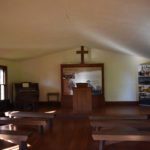
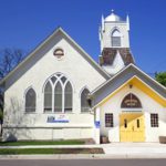
Ottawa Town Hall and Stone Church
View on Map Open in Google MapsStep back in time in this quaint village.
Ottawa Village Historic District, MN 56058507-665-2501
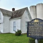
W.W. Mayo House
View on Map Open in Google MapsA small, Gothic-style house that was once home to the founders of the Mayo Clinic and Green Giant Company.
118 N. Main St.LeSueur, MN 56058
507-665-3250
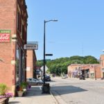
Henderson Historic District
View on Map Open in Google MapsMain Street in Henderson is a nationally registered historic district comprised of 13 vintage buildings all made from local red brick.
Main St. between 5th and 6th St.Henderson, MN 56044
507-248-3434
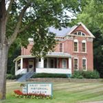
Sibley County Historical Museum
View on Map Open in Google MapsThis is a museum housed in an 1884 brick mansion.
700 Main StreetHenderson, MN 556044
507-248-3434
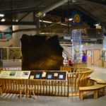
Joseph R. Brown Minnesota River Center
View on Map Open in Google MapsExplore this interactive displays and exhibits tell the stories of the Minnesota River, the history of a 33-county area, the life and works of Joseph R. Brown.
600 Main StreetPO Box 25
Henderson, MN 56044
507-248-3234
Ney Nature Center
View on Map Open in Google MapsThis is a Nature Center on acres of native prairie and woodlands along the bluffs of the Minnesota River.
28238 Nature Center LnHenderson, MN 56044
507-248-3474
Belle Plaine Historic Buildings
View on Map Open in Google MapsWith rich history dating back to 1854, the Belle Plaine and Minnesota Valley State Recreational Area greets you as you enter one of the gateways to the Minnesota River Valley National Byway.
Belle Plaine, MN 56011952-873-6109